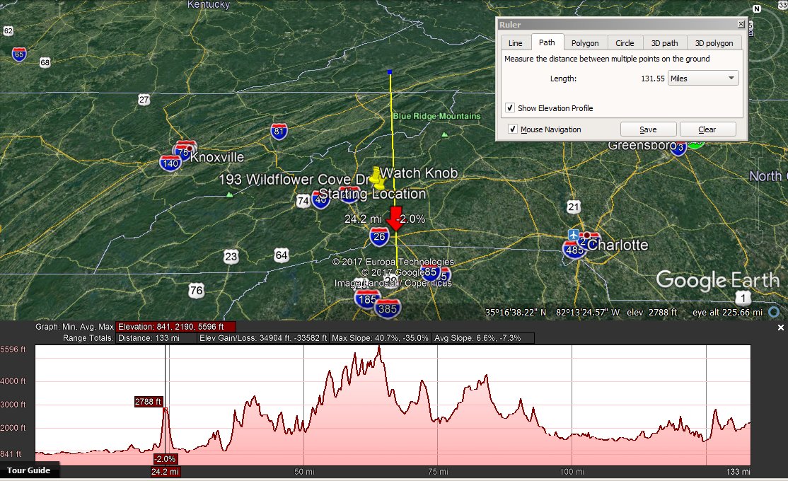
Warning!
The GSP radar site has two
coverage gaps which can be misleading,
especially with weather events coming from the west of WNC.
Ironically, the extent of the radar shadow gap can best be seen when
it's raining reasonably heavily, as seen in this example.
The primary shadow
is caused by the mountain that is on the SC-NC border along which I-26
runs.
A secondary
shadow occurs because of Cedar Mountain to the west of the
primary shadow and extends to Sevierville, TN.
FAA and NOAA/NWS coverage maps are available, but are difficult to keep
track of.
"Extensive updates" of February, 2018
have been unable to plug the gaps, even assuming mixed mode (H/V)
upgrades.
Path
obstruction diagrams - GSP radar site
|
|
|
The WDS-88D radar does a fantastic job through such terrain,
but images with small targets (e.g. tornado) should be treated with
care in these areas.
|
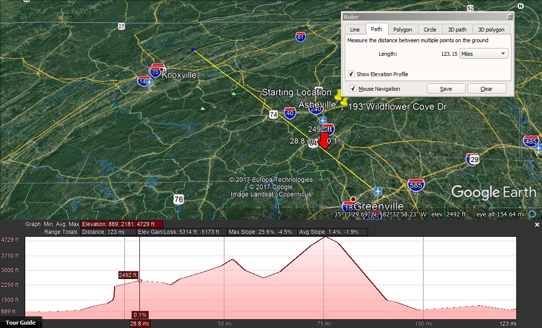
MRX - Primary
radar shadow (in red)
|

|
Warning!
The MRX radar site has a
large coverage gap which can be misleading,
especially with weather events coming from the west of WNC.
The extent of the radar shadow can best be seen when
it's raining lightly.
The primary shadow
is caused by the mountains that are along the TN-NC border.
FAA and NOAA/NWS coverage maps are available, but are difficult to keep
track of.
"Extensive updates" of February, 2018
have been unable to plug the gaps, even assuming mixed mode (H/V)
upgrades.
menu
footer
©
2003-2026 Hintlink. All
rights reserved.
IP footer
User Agent:
Mozilla/5.0 AppleWebKit/537.36 (KHTML, like Gecko; compatible; ClaudeBot/1.0; +claudebot@anthropic.com) IP Address:
216.73.216.136
 Wx
Radio
Wx
Radio