Hintlink

Hintlink

Home

Who we are  Capabilities

Applications - Latest versions Units of measure "Forecastfox" replacement 

News  Oil  Exchanges & Economics  

Weather Storms Climate Satellite Lightning Hail Snow Ice Air Fire Temperature Tropical Wind

Online Payments        Webmail            tripadvisor status

Add-ons: Seamonkey Firefox Thunderbird Chrome/Chromium

Open Source Applications

Open Source OS/GUI

Viruses, Spam & Security

RSS News feed

Hobbies / Guinea Pigs

Utilities  RF Exposure Calculator

WebCAM(1) (2)  (3)  More

Technologies  Product Designs 

 
  W4/VP9KF & G4BKI radio
 
  Data Policy  Disclaimer GDPR

Satellite (Updates every 11 minutes)
Page repaired after sudden removal of GOES-13 (East) from service. All images here are channel 07 (3.9um) on GOES-16, equivalent to GOES-13 IR channel.

Hintlink - wx header
Warnings Interactive Map Interactive Map Interactive Map Interactive Map Interactive Map Windyty Tornados
{Power outages:
Duke Notify National: Power outage USA Resource Stats Nova Scotia} | Blue Ridge Parkway Real time status | Foothills Parkway 

Please check time and date on all images when viewing them Not to be used for the protection of life or property

Hintlink - Satellite

SE GoM USA East Coast CONUS Tropical Atlantic Full Atlantic - Meteosat Storm Floaters RAMMB/CIRA Tropical (NRL) Tropical Spaghetti NHC


wx_menu
RadarRadar 24h loopStormsMosaicLightningLightning 24h loopSatelliteSatellite 24h loopHailSnow | IceAirFiresTemperatureTropicalWindStreamflowNC comboWeatherAsheville NC - turn your volume down first! Wx Radio
radar_menu
Radar:  Belize | MexicoFull USACanadaCubaPuerto RicoEastern CaribbeanGuadeloupe/MartiniqueBarbados | Trinidad & TobagoMiamiMiami Long RangeBermudaUK | UKW.EU (II)
satellite_menu
Satellite:   Belize & Mexico  | Full USA & Canada  | Cuba  | Puerto Rico & Caribbean  | Barbados  | Trinidad & Tobago  | Miami Long Range  | Bermuda  | UK  | W.EU (II) | "Forecastfox" replacement

South East  Click image to animate  Hintlink - Satellite

Default: 2 hours of animation - Band 7, 3.9um


wx_menu
RadarRadar 24h loopStormsMosaicLightningLightning 24h loopSatelliteSatellite 24h loopHailSnow | IceAirFiresTemperatureTropicalWindStreamflowNC comboWeatherAsheville NC - turn your volume down first! Wx Radio
radar_menu
Radar:  Belize | MexicoFull USACanadaCubaPuerto RicoEastern CaribbeanGuadeloupe/MartiniqueBarbados | Trinidad & TobagoMiamiMiami Long RangeBermudaUK | UKW.EU (II)
satellite_menu
Satellite:   Belize & Mexico  | Full USA & Canada  | Cuba  | Puerto Rico & Caribbean  | Barbados  | Trinidad & Tobago  | Miami Long Range  | Bermuda  | UK  | W.EU (II) | "Forecastfox" replacement

Gulf of Mexico Click image to animate  Hintlink - Satellite

SE GoM USA East Coast CONUS Tropical Atlantic Full Atlantic - Meteosat Storm Floaters RAMMB/CIRA Tropical (NRL) Tropical Spaghetti NHC

Default: 2 hours of animation - Band 7, 3.9um

wx_menu
RadarRadar 24h loopStormsMosaicLightningLightning 24h loopSatelliteSatellite 24h loopHailSnow | IceAirFiresTemperatureTropicalWindStreamflowNC comboWeatherAsheville NC - turn your volume down first! Wx Radio
radar_menu
Radar:  Belize | MexicoFull USACanadaCubaPuerto RicoEastern CaribbeanGuadeloupe/MartiniqueBarbados | Trinidad & TobagoMiamiMiami Long RangeBermudaUK | UKW.EU (II)
satellite_menu
Satellite:   Belize & Mexico  | Full USA & Canada  | Cuba  | Puerto Rico & Caribbean  | Barbados  | Trinidad & Tobago  | Miami Long Range  | Bermuda  | UK  | W.EU (II) | "Forecastfox" replacement

USA East Coast Click image to animate  Hintlink - Satellite

SE GoM USA East Coast CONUS Tropical Atlantic Full Atlantic - Meteosat Storm Floaters RAMMB/CIRA Tropical (NRL) Tropical Spaghetti NHC

Default: 2 hours of animation - Band 7, 3.9um

wx_menu
RadarRadar 24h loopStormsMosaicLightningLightning 24h loopSatelliteSatellite 24h loopHailSnow | IceAirFiresTemperatureTropicalWindStreamflowNC comboWeatherAsheville NC - turn your volume down first! Wx Radio
radar_menu
Radar:  Belize | MexicoFull USACanadaCubaPuerto RicoEastern CaribbeanGuadeloupe/MartiniqueBarbados | Trinidad & TobagoMiamiMiami Long RangeBermudaUK | UKW.EU (II)
satellite_menu
Satellite:   Belize & Mexico  | Full USA & Canada  | Cuba  | Puerto Rico & Caribbean  | Barbados  | Trinidad & Tobago  | Miami Long Range  | Bermuda  | UK  | W.EU (II) | "Forecastfox" replacement

CONUS Click image to animate Hintlink - Satellite

SE GoM USA East Coast CONUS Tropical Atlantic Full Atlantic - Meteosat Storm Floaters RAMMB/CIRA Tropical (NRL) Tropical Spaghetti NHC


Default: 2 hours of animation - Band 7, 3.9um

wx_menu
RadarRadar 24h loopStormsMosaicLightningLightning 24h loopSatelliteSatellite 24h loopHailSnow | IceAirFiresTemperatureTropicalWindStreamflowNC comboWeatherAsheville NC - turn your volume down first! Wx Radio
radar_menu
Radar:  Belize | MexicoFull USACanadaCubaPuerto RicoEastern CaribbeanGuadeloupe/MartiniqueBarbados | Trinidad & TobagoMiamiMiami Long RangeBermudaUK | UKW.EU (II)
satellite_menu
Satellite:   Belize & Mexico  | Full USA & Canada  | Cuba  | Puerto Rico & Caribbean  | Barbados  | Trinidad & Tobago  | Miami Long Range  | Bermuda  | UK  | W.EU (II) | "Forecastfox" replacement

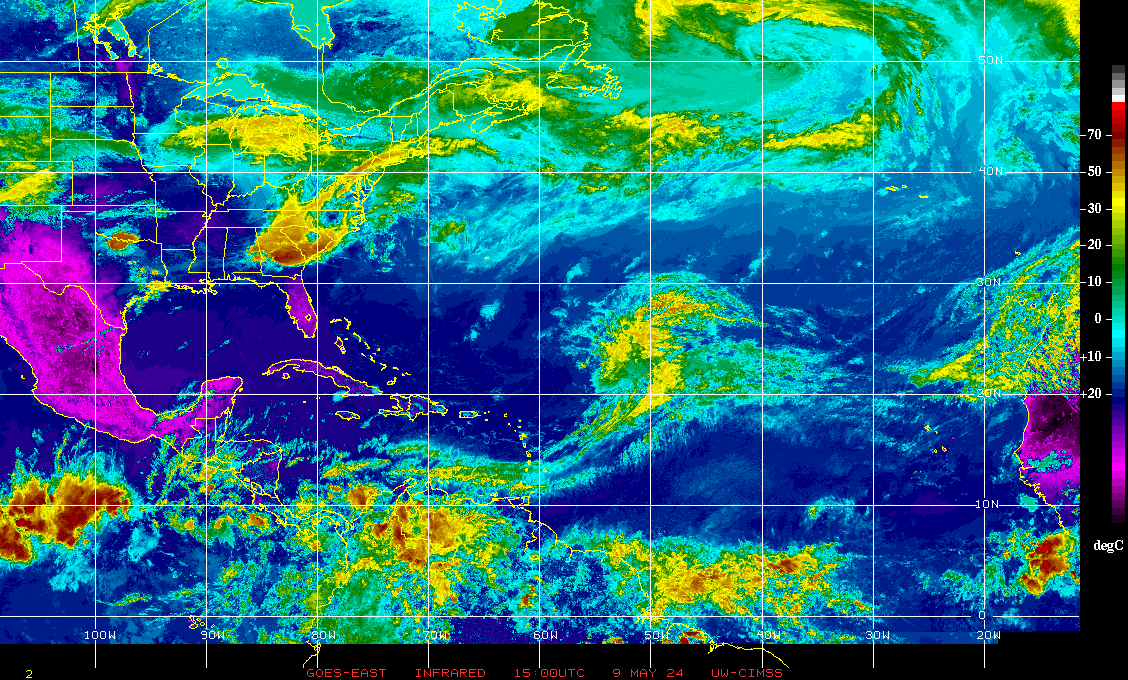
Tropical Atlantic  Click image to animate Hintlink - Satellite  FULL Atlantic

wx_menu
RadarRadar 24h loopStormsMosaicLightningLightning 24h loopSatelliteSatellite 24h loopHailSnow | IceAirFiresTemperatureTropicalWindStreamflowNC comboWeatherAsheville NC - turn your volume down first! Wx Radio
radar_menu
Radar:  Belize | MexicoFull USACanadaCubaPuerto RicoEastern CaribbeanGuadeloupe/MartiniqueBarbados | Trinidad & TobagoMiamiMiami Long RangeBermudaUK | UKW.EU (II)
satellite_menu
Satellite:   Belize & Mexico  | Full USA & Canada  | Cuba  | Puerto Rico & Caribbean  | Barbados  | Trinidad & Tobago  | Miami Long Range  | Bermuda  | UK  | W.EU (II) | "Forecastfox" replacement

Full Atlantic  Click image to animate Hintlink - Satellite
Full Atlantic; Default: 6 hours of animation - Band 7, 3.9um 
wx_menu
RadarRadar 24h loopStormsMosaicLightningLightning 24h loopSatelliteSatellite 24h loopHailSnow | IceAirFiresTemperatureTropicalWindStreamflowNC comboWeatherAsheville NC - turn your volume down first! Wx Radio
radar_menu
Radar:  Belize | MexicoFull USACanadaCubaPuerto RicoEastern CaribbeanGuadeloupe/MartiniqueBarbados | Trinidad & TobagoMiamiMiami Long RangeBermudaUK | UKW.EU (II)
satellite_menu
Satellite:   Belize & Mexico  | Full USA & Canada  | Cuba  | Puerto Rico & Caribbean  | Barbados  | Trinidad & Tobago  | Miami Long Range  | Bermuda  | UK  | W.EU (II) | "Forecastfox" replacement

Full HIMAWARI, GOES-W, GOES-E and Meteosat

Full Selection  Full Atlantic(+) Two day IR animation 

GOES status: 14 ('East', 105ºW) & 15 ('West', 135ºW) are being used for space weather data.

15 ('West', 135ºW) & 16 ('East', 75ºW) are being used for imaging. [GOES16 started 2018-01-08]

The replacement GOES East imaging site was initially poor, but is improving the selection of wider view images.


wx_menu
RadarRadar 24h loopStormsMosaicLightningLightning 24h loopSatelliteSatellite 24h loopHailSnow | IceAirFiresTemperatureTropicalWindStreamflowNC comboWeatherAsheville NC - turn your volume down first! Wx Radio
radar_menu
Radar:  Belize | MexicoFull USACanadaCubaPuerto RicoEastern CaribbeanGuadeloupe/MartiniqueBarbados | Trinidad & TobagoMiamiMiami Long RangeBermudaUK | UKW.EU (II)
satellite_menu
Satellite:   Belize & Mexico  | Full USA & Canada  | Cuba  | Puerto Rico & Caribbean  | Barbados  | Trinidad & Tobago  | Miami Long Range  | Bermuda  | UK  | W.EU (II) | "Forecastfox" replacement

Click image to animate Hintlink - Satellite


wx_menu
RadarRadar 24h loopStormsMosaicLightningLightning 24h loopSatelliteSatellite 24h loopHailSnow | IceAirFiresTemperatureTropicalWindStreamflowNC comboWeatherAsheville NC - turn your volume down first! Wx Radio
radar_menu
Radar:  Belize | MexicoFull USACanadaCubaPuerto RicoEastern CaribbeanGuadeloupe/MartiniqueBarbados | Trinidad & TobagoMiamiMiami Long RangeBermudaUK | UKW.EU (II)
satellite_menu
Satellite:   Belize & Mexico  | Full USA & Canada  | Cuba  | Puerto Rico & Caribbean  | Barbados  | Trinidad & Tobago  | Miami Long Range  | Bermuda  | UK  | W.EU (II) | "Forecastfox" replacement

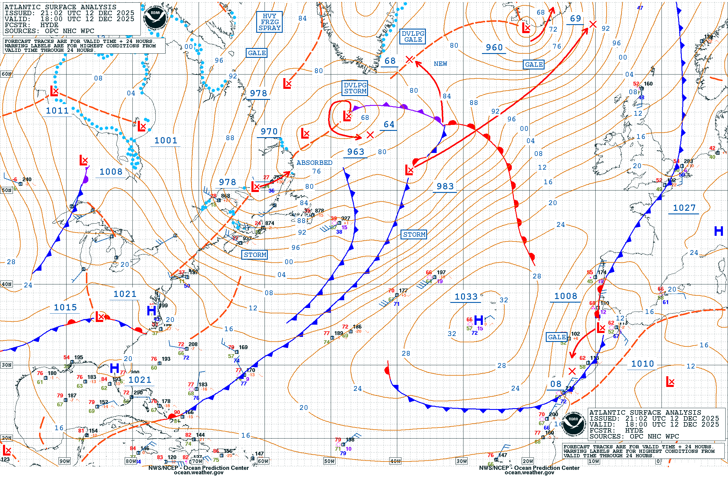
Not satellite, but full N.Atlantic

Wx station Links
Swannanoa, NC: Local weather stations and forecasts (abbv.)
Wx Station I
T,DP,W,WD,R,P
Wx Station II
T,DP,W,WD,R,P F
Wx Station III
T,DP,P
Wx Station IV
C,T,DP,W,WD,R,P,SR,UV F
Wx Station V
T,DP,W,WD,R,P F
Wx Station VI
T,DP,W,WD,R,P
Wx Station VII T,DP,W,WD,R,P Wx Station VIII T,DP,W,WD,R,P F Wx Station IX
T,DP
Wx Station X T,DP,W,WD,R,P Wx Station XI T,DP,W,WD,R,P,SR,UV F Wx Station XII
T,DP,W,WD,R,P,SR,UV F
Forecast WU today, WU 10 dayNWS, Foreca

wx_menu
RadarRadar 24h loopStormsMosaicLightningLightning 24h loopSatelliteSatellite 24h loopHailSnow | IceAirFiresTemperatureTropicalWindStreamflowNC comboWeatherAsheville NC - turn your volume down first! Wx Radio
radar_menu
Radar:  Belize | MexicoFull USACanadaCubaPuerto RicoEastern CaribbeanGuadeloupe/MartiniqueBarbados | Trinidad & TobagoMiamiMiami Long RangeBermudaUK | UKW.EU (II)
satellite_menu
Satellite:   Belize & Mexico  | Full USA & Canada  | Cuba  | Puerto Rico & Caribbean  | Barbados  | Trinidad & Tobago  | Miami Long Range  | Bermuda  | UK  | W.EU (II) | "Forecastfox" replacement

menu
Home  | Who we are  | Capabilities  | Web Hosting & System News  | News  | Oil  | Exchanges  | Weather  | Online Payments  | Applications - Latest Versions
Open Source Applications  | Open Source OS/GUI  | Viruses, Spam & Security Alerts  | RSS News feed  | Hobbies  | Utilities  | WebCAM  | Politics  | Software

footer
© 2003-2024 Hintlink. All rights reserved. IP footer
User Agent: Mozilla/5.0 AppleWebKit/537.36 (KHTML, like Gecko; compatible; ClaudeBot/1.0; +claudebot@anthropic.com) IP Address: 3.22.27.253